Speaking of a new year and a new start, today I will be exploring a new place. As titled, yes, I was heading to Malaysia for a hike!
I had to wake up early to prepare myself. Tiring...
To beat the traffic jam at the customs, we needed to be early, especially at weekends. So where are we heading today? Today's hike was introduced by LZ, she asked me to go for the hike because she needed someone familiar to hike with. I guessed that I would give this a try.
The first hiccup in the morning, I was supposed to take the train to the North but the sign said that they had changed their opening hour to a later time and starting from today! Oh dear, that's not good! Hence I could rely on a bus as there won't be any passengers in the early morning... But... The bus was slowed down by cyclists and it stopped at every stop...
...which made me a latecomer... Luckily, they are a group of kind people.
What do you know? We arrived at Malaysia customs 🛃 at ease. To my surprise, the minibus took the bus lane which beat most of the traffic!
Ah, introducing Na whom I have known while I explored the Oil Refinery Factory and coincidencely, he knows one of my ex-students, Ed! 😂 What a small world.
Even the queue isn't long, what a smooth journey!
Oh! We spot a classic Malaysia bus at the customs and love its unique shape from what Singapore buses look like.
Finally got a chance to travel overseas (over the border I think) I sat at the back and it was a bumpy ride until I couldn't focus on having a selfie.
Clear sky meaning we might have a dry hiking trip today! Yippee!
Time to stop somewhere to have breakfast together.
Ooo, this place! I came here before with EK but I didn't get down to check this place up.
This place hmm... persatuan muhibah penduduk taman ungku tun aminah. So... What does it mean? 😂 I tried to Google it, but it did not give me the info I needed. I tried to trace it, it should be here, Taman Ungku Tun Aminah. The residential living conditions are a bit "rural" and like Hong Kong's old streets. I don't know how to describe it, but I know that here, you can sense how simple and authentic Malaysian life of living.
We arrived at one of the car parks beside Pulai Kangkar (map link)
Let's have a group photo together.
Up here, there is a Hindu Temple. I thought we were ready to go, but the organiser told us that we should start somewhere else; he also shared there are many entrances at Kangkar Pulai...
Looking at this temporary car park can tell there are many hikers already came to this place for a good hike.
We had a group of expert hikers (the ones in green) to lead us hiking through this mountain.
Happy Hiking Johor
Official group photo before we started.
We started from this point.
Everyone seemed confident and excited to hike.
Upslope? No problem.
Na, are you excited?
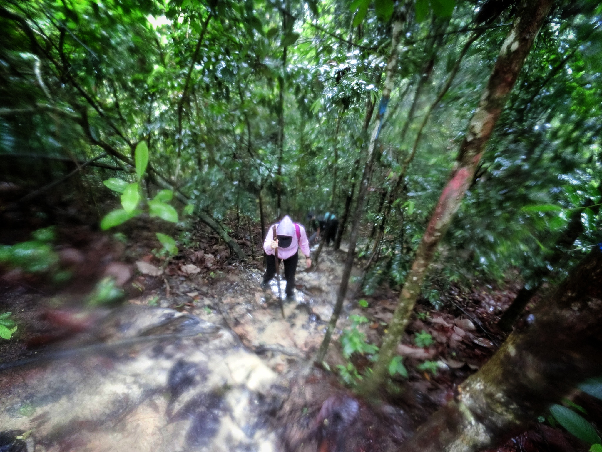
hmm... upslope with muddy ground... seemed no issue for me but some ladies already had some issues
When there is up there will be down...
It seemed like hiking in Singapore.
It seemed like it was a challenge for some people for the hike... They had problems balancing themselves.
Perhaps due to the slippery ground and steep slopes... If you can't balance or stabilise your feet, your butt will kiss the ground and receive free mud paint.
Amazing how they discovered the route and know how to navigate through the woods.
Smile ladies!
As an experienced hiker myself (time to vomit 🤮) stepping on the plant roots, is the best way to go down the slope.
Check the wet ground, those are sticky mud-like clay. You can't depend on the stick to assist you to get over it.
These days, I have been wondering... How did these giant rocks get to this spot? If I can view back history, I would love to.
While moving down the slope, we encountered a thorny plant in which most of its thorns were chopped off to protect hikers from potential injuries.
Oooo, a great setup bridge for hikers. Request to whoever set this up.
(credit Na) Na brought his DSLR so I asked him to snap for me. Thanks for the picture. I guess the model is too bad to be shot.
Amazing root system here to hold the ground.
More upslope.
We were waiting here for the rest of the team, feeding the mosquitoes and letting the ladies admire the handsome gentleman as their guide.
Hmm 🤔 did I hear something?
Rain was coming from a distance. My prediction was wrong... When I believed, it would rain by the evening... Rain + mud is not a great combination!
Before this log turned wet, better crossed it quickly.
Amazing vine that twisted beautifully
THE RAIN COMES!!!!!!!!!!!!
The ground got more dampened...
...and slippery!
FLOWS OF UNSTOPPABLE MILO!
We managed to get to the top (Temporary stopping point)
At least, most of the members were safe.
The last member was trying her best to climb up the slippery slope. And after a short discussion on the limitations and conditions that our team had. They decided to divide it into two teams - one would cover Pony and Dinosaur Rock, then Blue Lake. Another is to take the shortcut to the Blue Lake.
So you already knew my decision!
Let's go!
What do you know? The rain stopped!
Some more boulders around here... I felt something...
But I kept forgetting what I was trying to ask myself...
Hmm 🤔 I felt that the question I had... Was raised a long time ago and I forgot to find out...
Check out how tall these trees are
Along the way, it might seem an easy route but worse to come.
I slipped and almost fell down, as I managed to get hold of myself - resulted a muddy palm.
The guide told us to find "a Great Wall of JB", we just needed to climb down the slope and a bit up to see the amazing scenery. The mud here was sticky and slippery because there was no root to hold the ground.
Hmm... I wonder how a vine grows, it can get woody over time.
It seemed they were far away from me. I had to double my pace to catch up.
Another slippery place and I almost got another muddy palm again.
Ooo... Something unique here is the fungus growing on the broken branch like flowers 🌸
(Credit the guide) it looked like a cherry branch.
Tada! We had arrived at the "Great Wall of JB"... I was rather disappointed 😂 basically it is a huge boulder!
The boulder is filled with green moss...
...with water dripping down from the sky.
I wondered what it looked like on top of the boulder.
Honestly, the disappointment was gone and I was simply awed by the size and made me feel so small by standing beside it.
Due to this place has no name, and the locals had to come up with something for them to describe the locations, so they named this place as "Great Wall". I will say it is a Great Wall, not China but the Great Wall of Nature.
I feel protected by the wall somehow because I know it won't topple on me.
(Credit the guide) Happy group to explore altogether.
Besides one huge boulder (from the start), it is also stacked with other boulders.
I love how "smooth" they are...
...and the thick moss found here.
🤔 Hmm the feeling came back again... The feeling of curiosity... What is the thing I want to know... Oh well... I will know what I want later...
Water droplets landed on the leaves looked like a beautiful crystal ball. I didn't take out my phone to capture these, I should have.
Wow, this Large Wall is quite a big boulder! We had to walk a distance to reach to its another end.
Amazingly, this is one boulder itself.
There are plants living comfortably here.
Time to move up the slope.
Ooo, this boulder looks so smooth.
Ah, this boulder erects out from the ground, we won't know how deep it is beneath it.
Based on the guide, now we are heading to Pony Rock.
My mind was still wondering unsatisfied... Like I had that thought in my mind for a long time... But It seemed like I couldn't complete it...
Group photo to celebrate that we had cleared so far.
What a beautiful and recognisable landmark, but it has no name yet. It looked like it was struck by lightning but nope...
From the look of it, It looked more like inner decay and caused the tree stem to snap. If it was caused by lightning then we would see a burn mark.
I shall name it Tree Bridge. I should get its pin and register on Google Maps! I forgot!
Here it was, another landmark named Pony Rock. Are you able to figure it out? Really test your imagination.
(credit guide) Every lady wants to kiss the pony.
They told us that we were quite near a stop point.
These vines gave me wild ideas but better not because too muddy and a lot of ants!
Ah, here was our first stop - Kopitiam 2.0. I wondered why... Because many hikers will stop here and chill with a cup of warm kopi (coffee/tea) Na seemed like he couldn't move so he stayed back to look after our bags
Proceeded to the next spot.
Without a bag was such a great way of hiking.
What a big boulder above my head.
I think I know what is my "constipation" thought! How is a boulder formed? How did they get here? What gave them the shape or size? Who placed them here?
(Credit Guide) If I am poor, I will make this spot a house - perfect to stay stable and sheltered!
Ah, this one. The guide said we had arrived to Dinosaur Rock.
I was like... What? This is beyond my imagination. How does this look like a dinosaur?
Until a member pasted a sticker over my image in the chat group, and then I realised her creativity was at 101%! Salute!
From another view, as I got closer, it didn't look like anything other than claws or an anaconda looking at us.
(Credit Guide) What a beautiful rock
Hmm... I wondered are they really trusted me by leaving me behind so that I could take care of myself or ignored me? Haha... I believe that I seem independent and can be trusted to follow the team.
Time to walk back before we went down to see the Great Wall.
Thanks goodness, there was no rain, I can imagine if it rained, the mud here would be unforgiving.
Here is a special boulder, shielded by two boulders.
(Credit Guide) Another ideal potential housing location.
I could hear traffic nearby somehow... and the guide told us that we were about to reach our destination - Blue Lake.
Unique yellow boulder here.
We had arrived!
Kangkar Blue Lake!
(Credit Na) YES! FINALLY! I had been seeing many posts of this blue lake online, and now I got to see this quarry myself!
(Credit Na) Thanks for using your DSLR for this shot.
Nice granite. Besides Singapore mining for building materials, Malaysia also had a similar approach.
Thank you, Mountain for taking care of everyone here.
Right after I exited from the hike, the rain started to come!
Heavier rain started to shower the land!
(Credit Organiser) After the hike, we went for a good vegetarian feast and it tasted great!
I felt great to explore other locations (Especially overseas) together with people who accepted me. I hope to visit some other places in future.
Okay! Back to the question that I had in mind, How is a boulder formed? Long story short - They are igneous rocks. Singapore and Malaysia, even Indonesia, there are tectonic plates which form extended crusts; and active volcanos formed and created many minerals - granite and other minerals which I barely registered well myself. As time went on, through volcanic activity, molten rock cools and solidifies into large boulders, in addition to glacial movement which transports and deposits those boulders across the landscape. So whatever rocks that we see locally or overseas, they have stories to share and it is the Force of Nature which we should not underestimate.
This video has one of the best illustrations to explain glacial movement.
This one explains how volcanic activity formed rocks.
Good information on explaining most of what I am looking for.


Hi wanted to get in touch with you. Saw your profile on Twitter. Tele chubbear888
ReplyDelete